
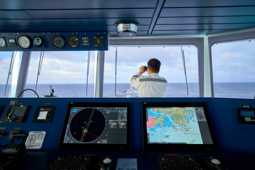
Official Electronic Navigational Charts for Safe and Compliant Marine Navigation
Charts International is an established supplier of Electronic Navigational Charts (ENCs) for commercial shipping, marine operators, offshore companies and other professional maritime users. As an appointed distributor of the British Admiralty (UKHO) and the South African Navy Hydrographic Office (SANHO), Charts International provides access to official electronic chart products designed to support safe navigation and modern ECDIS-based operations.
With offices in Cape Town and Durban, Charts International serves customers throughout Southern Africa and can also supply maritime chart products internationally.
What are Electronic Navigational Charts (ENCs)?
Electronic Navigational Charts are official digital vector charts produced by hydrographic offices for use with Electronic Chart Display and Information Systems (ECDIS) and other compatible navigation systems.
Unlike raster charts, ENCs contain individual digital chart objects such as depth contours, buoys, navigation marks, coastlines and restricted areas. This allows ECDIS to display and interrogate navigational information and provide features such as automated warnings and alerts.
For vessels using ECDIS, official and up-to-date ENCs are an essential part of modern navigational operations.
Admiralty Vector Chart Service (AVCS)
Charts International supplies the ADMIRALTY Vector Chart Service (AVCS), the UKHO’s global digital chart service.
AVCS brings together official ENCs from hydrographic offices around the world into a single service. Charts International’s website states that AVCS includes more than 13,800 ENCs, providing extensive coverage of major shipping routes and ports worldwide. The service includes coverage of thousands of major ports, with Charts International offering unique coverage for more than 150 ports.
Key AVCS benefits include:
*Official ENC data supplied through the UKHO’s AVCS service.
*Extensive worldwide coverage for major shipping routes and ports.
*ENCs supplied in industry-standard S-63/S-57 formats.
*Compatibility with ECDIS systems across different manufacturers.
*Weekly ENC updates delivered by internet download, email or disc.
*Certification supplied for local inspection.
ADMIRALTY Information Overlay (AIO) supplied to AVCS customers at no additional cost.
The regular updating of ENC data helps vessels maintain current navigational information and supports compliance with applicable flag and port-state requirements.
South African Navy Hydrographic Office (SANHO) ENCs
Charts International is also an appointed agent and distributor for the South African Navy Hydrographic Office (SANHO).
SANHO is South Africa’s national hydrographic office and produces paper charts, electronic navigational charts and nautical publications. Its work supports safe navigation along the South African and Namibian coasts and serves government, commercial and other maritime users.
Through Charts International, customers can obtain the latest SANHO charts, publications and ENC products for their operational requirements.
ENC Updates and Chart Management
Keeping electronic charts current is an important part of safe navigation. ENC updates can incorporate changes to navigational information, including new or altered aids to navigation, hazards, depths, port information and other hydrographic data.
Weekly ENC updates through AVCS are available. Regular electronic updating helps reduce the manual work associated with paper chart corrections while ensuring that navigation systems have access to the latest available chart information.
For vessels operating under SOLAS requirements, we advise that official ENCs used with compliant ECDIS can form part of an appropriate electronic chart carriage arrangement. Official charts should be kept up to date and suitable backup arrangements must be maintained where required.
ENC Supplier for Southern Africa and International Customers
Charts International provides electronic chart solutions to customers from its offices in Cape Town and Durban, South Africa.
Whether you require Admiralty AVCS coverage for an international voyage, SANHO ENC coverage for South African waters, or assistance selecting charts for a planned route, our team can help identify the appropriate official electronic navigational chart products for your vessel.
Our experienced team can assist with:
*ENC selection and coverage requirements
*Admiralty AVCS
*SANHO electronic navigational charts
*ECDIS chart requirements
*ENC updates
*Digital chart licensing
*Voyage and route coverage
*Official chart and publication requirements
Why Choose Charts International?
Charts International is an official distributor of major maritime chart and publication providers, including the British Admiralty (UKHO) and South African Navy Hydrographic Office (SANHO). The company also supplies publications from the International Maritime Organization (IMO) and International Telecommunication Union (ITU).
This enables customers to source official navigation charts, digital chart services and related maritime publications through an established specialist supplier.
Request ENC Information or a Quote
Looking for an Electronic Navigational Charts supplier in South Africa?
Contact Charts International for advice on ENC coverage, AVCS, SANHO products, ECDIS requirements or a quotation for your vessel or planned voyage.
Charts International – Cape Town
Unit 23 Foregate Square
Harbour Road
Cape Town, South Africa
Tel: 021 419 7700 / 01
Cell: 082 787 7687
Email: sales@chartsinternational.co.za
Business hours: Monday–Friday, 08:00–16:30.